

Death Valley National Park had not been a place I had been thinking about recently, and going there hadn't even crossed my mind, when a little video popped up on my Facebook feed one day. The video talked about how the El Niño rains of the fall and winter were creating a bloom of wildflowers in the barren desert park special enough to be labeled as a "super bloom" year. That's when the idea struck. I realized that without a job, the travel bug starting to gnaw away, and nothing preventing me from traveling, this just might be the remedy the doctor had ordered for my so far rocky spring. I did some research, ordered a map and a guide book (Hiking Death Valley by Michel Diconnet, a great book with excellent references and historical information, all historical antidotes in the following write-ups come from his guide), and set about planning the adventure. And so I found myself, a few weeks later, dragging myself out of bed at 4:00 AM on a Saturday morning, throwing a few last minute things into the truck, and saying my goodbyes to Lex (Unfortunately, due to strict National Park regulations on pets I had decided it would be best to leave my trusty side kick at home for this trip). A couple of friends had been interested in joining but had been detained by the rigors of school and work, and so it was only Ashley and I that hit the road before sunrise that Saturday.
Day 1
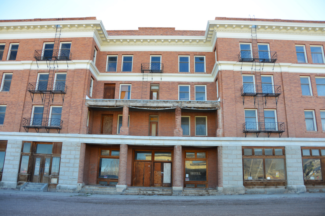
Dawn found us cruising the main street of Island Park. All 33 miles of it. Apparently, due to state liquor laws banning sales outside of city limits, resort owners decided to incorporate the area into a "town," and claim it as the longest "main street" in the world. I can't speak for length, although I will say it must have the most speed limit changes on any "main street" in the world... Idaho Falls, Pocatello, and Twin Falls passed by the windshield, and we finally found ourselves entering Nevada's border town of Jackpot around noon. We filled up our tanks with gas and PB&J sandwiches and resumed pounding the pavement. A determined head wind tried its best to rebuff us, but we prevailed and dusk found us rolling into Tonopah Nevada. We cruised down the main street, surrounded by desert mountain tops and the ruins of mining's heyday, and pulled into the parking lot of the Mizpah Hotel. The Mizpah is a historic hotel that was recently renovated, and boasts period furnishings, as well as several period ghosts. The spirits in residence are said to include a murdered prostitute, two children, and two miners supposedly murdered by a third after tunneling from the Hotel's basement to the bank vault next door. We quenched our hunger with delicious barbecue and beer at the Tonopah Brewing Company before crawling into bed, tired after a long days drive.


Day 2
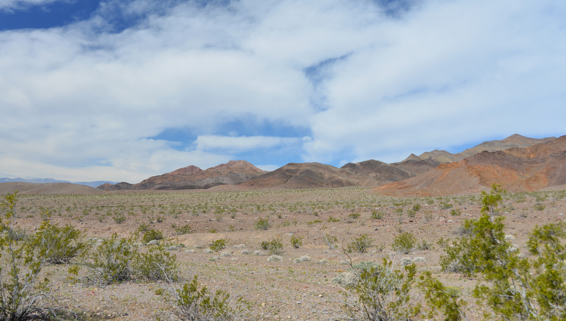
No ghosts visited us during the night, and we awoke the next morning refreshed and ready to go! Fueled by coffee and muffins, we loaded the truck and turned the wheels towards Beaty, NV. The road took us through the old mining town of Goldfield, now nothing more than a few houses, tourist shops, and the crumbling remains of the town's once grand hotel. The Goldfield Hotel is supposed to be quite haunted and has featured on several paranormal TV shows. After a quick stop at Goldfield, we soon found ourselves rolling across the state line into California, and into Death Valley National Park. Stopping at the kiosk to pay our entrance fee, we were greeted with our first views of the park, and its first offerings of wild flowers. Neither disappointed.


The original plan had been to find a campsite at the Wildrose campground or one of the other three campgrounds that do not have a charge for camping (my aversion to paying for a campsite if at all possible had narrowed our choices). With this in mind, we decided to find a home for the next few days before we did any exploration. Passing by the Mahogany Flat Sand Dunes and Stovepipe Wells Village, we soon found ourselves at the junction of the Wildrose Road and the Emigrant campground. Emigrant campground turned out to be nothing more than a large gravel parking lot with picnic tables, and even had there been a spot available, there was no way we were staying there. Wildrose campground was the next to be eliminated. The campground was nice, but the road to get to it is long, extremely windy, and it quickly became apparent that driving in and out of it everyday would be impractical and quite annoying. With the other two free campgrounds even farther up Wildrose road, we decided that backcountry camping off one of the many back roads of the park would be the way to go. Not only would it be more pleasant, it would allow us to move our camp close to the next days objective, allowing us more time to explore. Why I even considered the campgrounds over backcountry camping I will never know, but it was the best decision of the trip, and I will not consider anything else when the next trip comes around!
With the decision made, we returned to the main road and passed through Furnace Creek towards Echo Canyon. After missing the discretely signed turn off for the 4WD road we turned around and made it on the second attempt. Numerous people were camped along the gravely wash but we easily found a nice camping spot just downhill from the mouth of Echo Canyon proper. We explored a bit of the lower canyon on foot and climbed to a nice vantage point above camp before setting up for the night and throwing some steaks and potatoes on the stove for dinner. We enjoyed dinner and the night sky before turning in for the night, excited for the first full day of exploration!


Day 3
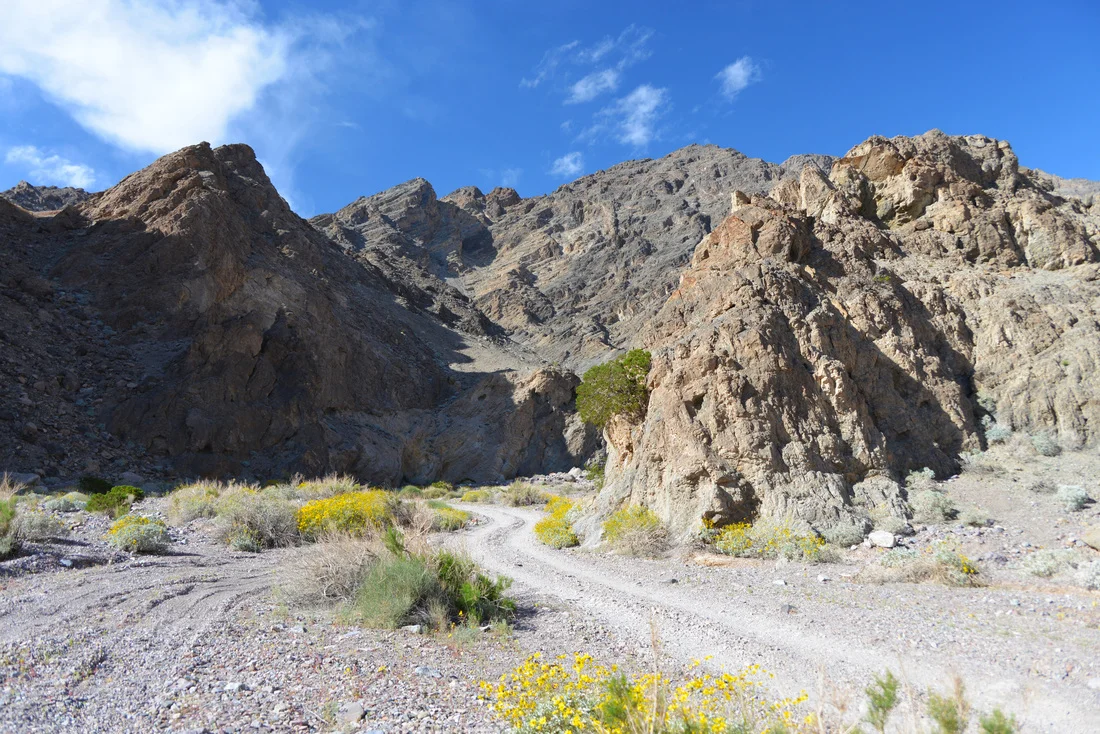
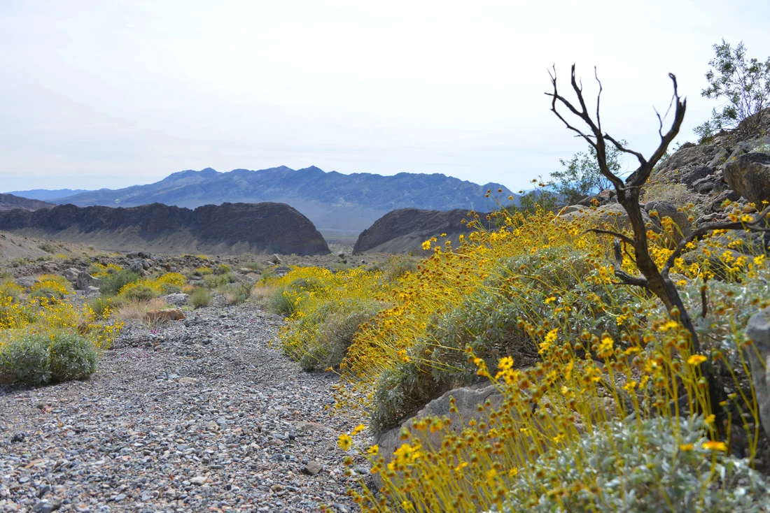
Fresh coffee in hand, we pilled back into the truck and continued up the Echo Canyon road. The road follows the wash of the canyon and consists mostly of loose rock, with a few small boulders thrown in to make line choice a little more interesting. Although it is not a particularly narrow canyon, the steep rock walls come within a foot of the road at places, and around every bend we were greeted by dramatic desert scenery and wild flowers. After about a quarter of an hour the steep walls began to retreat as the canyon opened up into a striking high desert valley, and before long we were pulling into the parking pullout at the old Inyo Mine with only one other car and none of its occupants to be seen. This is the end of the road for most travelers, though dedicated jeepers can continue up a different fork of the road over a mountain pass and eventually back into the Beaty area. We had passed a large group of Jeeps coming up the canyon so we decided to take advantage of the solitude and put boots to the ground before more people swarmed the area.
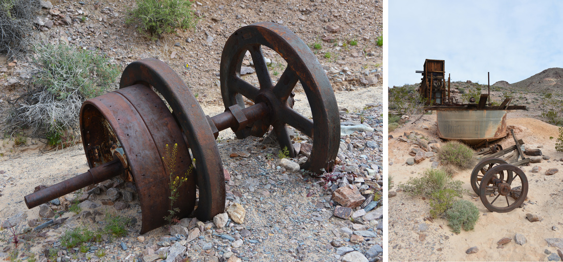
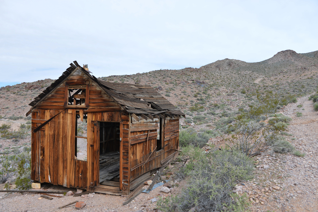
Inyo Mine consists of half a dozen buildings in various states of collapse scattered across the base of the hillside. The remnants of the old gold mill tower over the west side of the camp and a small dugout shelter from the early 1900s lurks on the far end. The east side of the camp contains the old boarding house and the old cook house. The main mines are located high on the hillside above the camp, the main shaft marked by the large ore bin perched on the steep slope. Additional mine shafts are scattered around the hillside and hidden on the backside of the mountain. Gold was first discovered here in 1905 by Maroni Hicks and Chet Leavitt, and by the spring they had staked claims on all of the most promising locations. By the end of the year a group of Utah mining investors bought the claims and the Inyo Gold Mining Company was incorporated. The mine was developed for the next two years with most work occurring in the winters, employing up to 30 miners. However, the ore was not good enough that it could be profitably shipped without milling, and by 1907 when the great financial panic struck, the company was in debt and the mine closed by the end of the year, remaining idle for several subsequent years. In the mid 1930s the mine was leased to a new owner and revived, producing and shipping mid-grade ore until lack of funds caused the mine to close again in 1938. Although the mine produced a small quantity of high grade ore in the subsequent years, it was not enough to sustain continued mining in such a remote location, and the mine shut down for good in 1941.


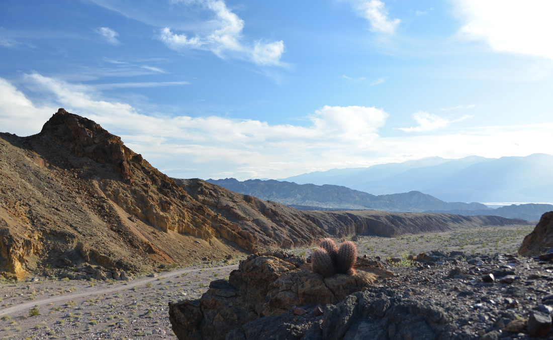
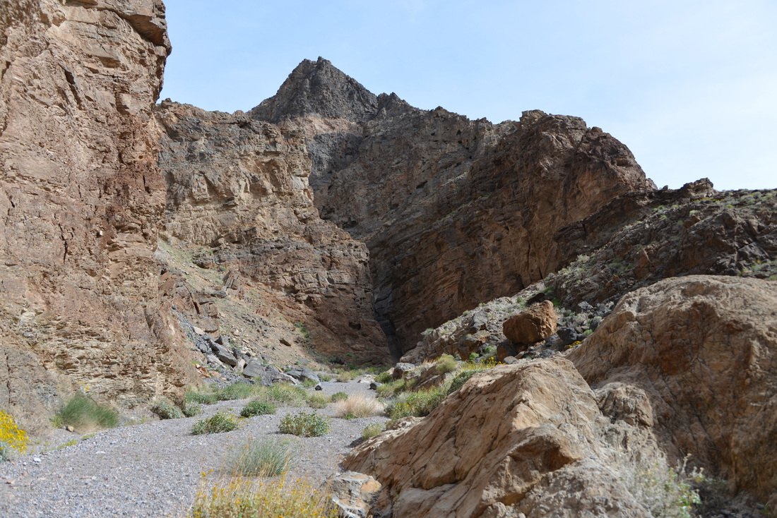
As with all old mining areas it would be easy to spend an entire day exploring the relics of a bygone age, but we had other sights to see and the Jeep group had arrived and were crawling over the area like ants. Taking our cue, we reluctantly said goodbye to Inyo Mine and retraced our tracks down the canyon. The drive back down was uneventful until we came around a bend and came face to face with The Eye of the Needle, which had eluded us on the drive up that morning. After taking a break for a few pictures around this unique arch we exited Echo Canyon and soon were rolling on pavement once again. The pavement was not destined to last long, however, as Hole in the Wall and an afternoon hike up Slit Canyon was on our list next! Right after a drive through 20 mule team canyon that is...


The Hole in the Wall road proved to be a little rougher, but our destination was not far, and before long we found ourselves face to face with the feature the area is named after. The Hole in the Wall is a large gap in a striking barrier of upthrusted conglomerate towering 300 to 400 feet above the wash, pockmarked with cavities resembling a block of Swiss cheese, that bisects the alluvial fans coming out of the mountains. This was to be our trail head for the afternoon, so we parked the truck, loaded some PB&Js and snacks in our packs, and set out up the wide wash and alluvial fans towards the mouth of Slit Canyon. The mouth of this canyon is tucked back in the mountains and is quite hidden from a distance, but our estimate proved to be accurate and the canyon mouth presented itself as we climbed up the fans. Less than a quarter of a mile into the canyon we came face to face with the first obstacle, a sharp 90 degree bend in the canyon guarded by a set of two climbable dry falls around 12 to 18 feet high standing at the foot of an impassible 25 foot dry fall that must be bypassed to continue up canyon. We decided this would be a good place to lighten our packs of the lunches we packed, so we found a nice rock to relax on and enjoyed our sandwiches in the shade of the canyon's towering walls.
After a quick climb up the first fall for the sake of exploration, I rejoined Ashley and we proceeded to scramble up the wall of the canyon on a rough hikers trail, descending back to the canyon wash upstream of the dry falls. Upon reentering the wash we found ourselves in a classic desert canyon with narrow walls towering above us and an assortment of dry falls to climb, most formed by steep patches of slick rock polished by raging water, others from large boulders long ago wedged in narrows and buried on their upstream side. The most challenging of these falls resides at the end of the narrows which the guide book calls the Slit. The Slit is a straight and narrow passage only a few feet wide running for close to 100 feet along the canyon ending in a slanting 15 foot dry fall. Although a fairly easy scramble, the last part of the climb is somewhat exposed and holds were small making for a bit of a challenge. We continued on up the canyon, eventually reaching a stunning 50 foot dry fall, the focal point of which is a vertical chute about four feet wide and a two to three feet deep into the rock that runs the length of the fall. This formidable obstacle is impassible, and required another scramble up and over a sub wall of the canyon to bypass. Arriving back in the wash, the canyon continued to unfold in a series of narrows, small dry falls, all sprinkled with a generous allotment of wildflowers


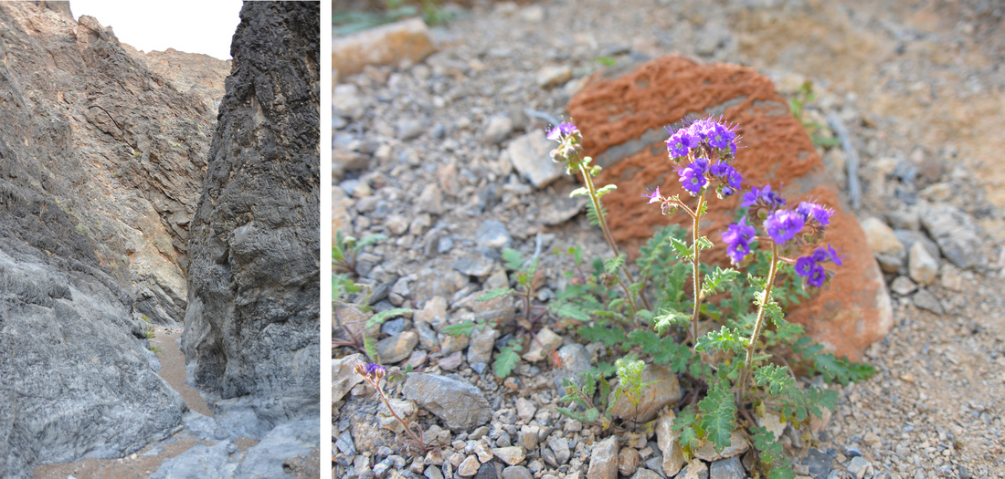


The canyon was breathtaking, and every bend brought new sights, but all good things must come to an end, and the sun was sinking ever lower in the sky. Exiting the canyon we were greeted with a spectacular view of the alluvial fans and Hole in the Wall awash in late day sunlight. We marveled in the sun, the view, and the striking wildflowers as we descended back to the truck where we were met by an older couple bird watching and looking for a rare endemic wildflower. After exchanging stories and locations where we had not seen their flower, we parted ways. For us it was back to camp, our day was done. The Zabriskie Point overlook was on our way back to camp in Echo Canyon, so we stopped and took in the view of the badland hills in the evening light before continuing back to our camp. We settled down to fish tacos, hot chocolate, and the brilliant night sky before crawling into our sleeping bags, tired and satisfied after a long day of exploration, unaware of the challenges the next day had in store for us...


